
Ensure smooth digital service delivery to citizens, businesses and other governments? Rely on a solid partner to help collect, organize and share your geodata.
Our answers to challenges for Datadriven governments
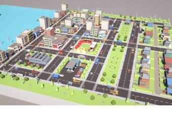
Building out a geographic data infrastructure
Everything depends on a well-developed geographic data infrastructure (GDI). To build that GDI, we work in a standardized and interoperable way, based on the standards of the Open Geospatial Consortium (OGC) and INSPIRE principles. This makes it easy to communicate with other systems and infrastructures.
The result? Geodata becomes easily findable, accessible and reusable, both from a management and technical perspective. This is how you lay the foundation for building a true Geo Digital Twin.
At GIM, we tackle this in four steps:
1) A GIS audit identifies the strengths and weaknesses of your current system.
2) A roadmap describes the migration from your current situation to a high-performance GDI.
3) You get advice for building your architecture and choosing the software.
4) Then follows the implementation of the GDI, integration with other business systems, migration of data and possibly a custom software development.
Want to know more?
Find out how VLAIO is betting on better data exchange thanks to OSLO business park.
Read about the successful INSPIRE data harmonization for the Grand Duchy of Luxembourg.

Use geodata smartly and improve your services
When opening up your data to a larger public (open data), it is best to proceed thoughtfully. GIM thinks with you about the standards you should use and offers you sophisticated technical solutions.
If you want to make your data available via a geoportal, we think with you about the organisation of your data, the target groups you want to reach and the services you want to provide. We help you manage user rights. Moreover, we can also make geo-data available via mobile devices.
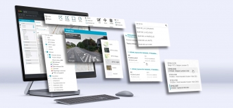
Make your geographical information accessible
Want to communicate better with citizens, visualize data clearly in a geoportal or improve your policy implementation? With the state-of-the-art technology of our custom map applications, you get clear spatial insights.
Our Geo-ICT team has been building applications for managing and using geo-information for over 25 years. From advice to implementation: we find the solution that best meets your needs. With the organization of your data, the target groups you want to reach and the services you want to deliver as essential pillars.
Want to know more?
Read how Brussels goes for smart parking with interactive map applications.
Read how 4Werk simplifies on-site inspection of fire hydrants thanks to mobile map app.
Read how the Flemish Traffic Centre offers motorists a clear view of traffic situations.
Read how Brussels goes for smart parking with interactive map applications.
Find out how a practical geo-tool paves the way for sustainable forest management.
Contact us
Your input was sent successfully.
Error
Your contact person

An Heirman
+32 (0)16 40 30 39 +32 (0)16 40 30 39
Service Desk
Already a customer? How can we help you?
Service Desk