Up-to-date and accurate geo- and demographic information about developing regions is a must for international organizations and NGOs. This allows them to set up their facilities in the most appropriate location and coordinate their development assistance efficiently.
Our answers to challenges for International organizations and NGOs
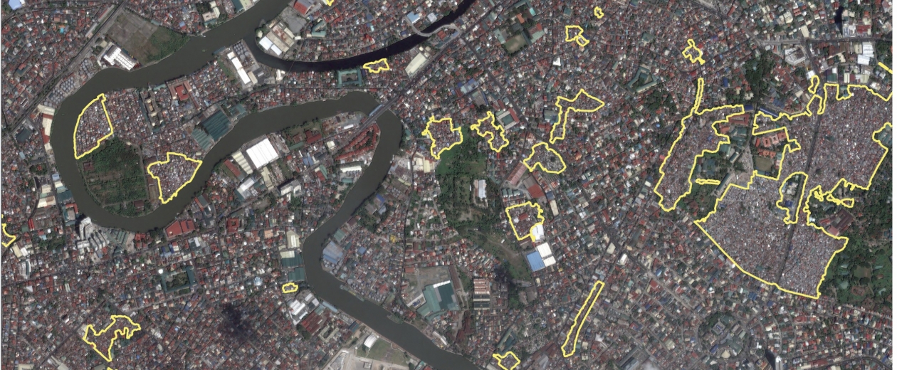
Detecting and mapping settlements meticulously
To give development aid decisiveness, you need not only reliable demographic information, but also accurate geo-insights. Yet information about developing countries is often lacking or changes every other minute.
Determining the size, population density and growth of slum areas? Detecting human settlements, infrastructure and changes in the (urban) landscape? GIM’s Earth Observation services use satellite images to formulate an answer to questions from aid organizations or NGOs. In this highly cost-efficient way, you acquire objective geographic and demographic analyses about developing areas, no matter how large they may be.
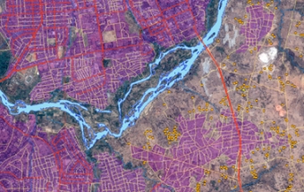
Want to know more? Discover how GIM mapped the Nigerian states of Kaduna and Bauchi in order to guarantee the success of the UNICEF and WHO polio vaccination program.
Contact us
Your input was sent successfully.
Error
Your contact person

Véronique De Laet
+32 16 40 30 39 +32 16 40 30 39
Service Desk
Already a customer? How can we help you?
Service Desk