eHealth Africa uses satellite imagery to fight polio
eHealth Africa uses satellite imagery to fight polio

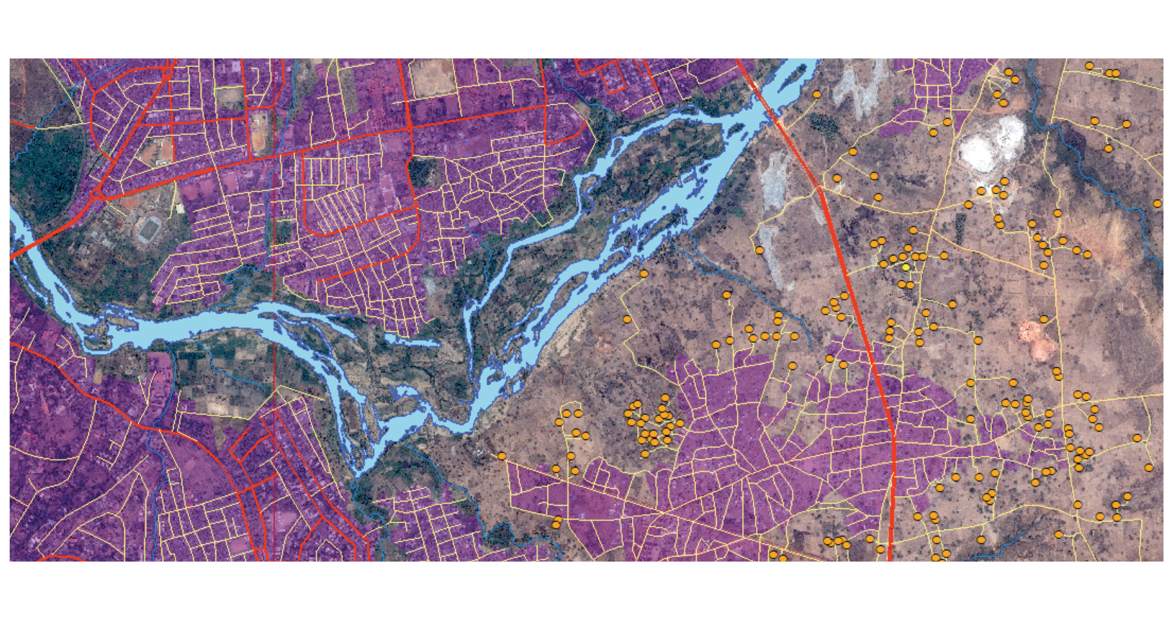
GIM improves the effectiveness of the polio vaccination program by mapping the Nigerian states of Kaduna and Bauchi.

eHealth Africa uses satellite imagery to fight polio
Polio, or infantile paralysis, is still claiming many victims in Nigeria. As part of the Global Polio Eradication Initiative, various NGOs have put their weight behind a large-scale vaccination campaign, since every child needs to be vaccinated in order to put an end to the virus once and for all. eHealth Africa came up with the plan to improve the effectiveness of the vaccination campaigns of UNICEF, WHO and the Nigerian government based on advanced technology.

The challenge
GIM was commissioned by eHealth Africa to map the whole of the Nigerian states of Kaduna and Bauchi. The vast area (100,000 km²) posed a huge challenge, as did the great morphological diversity of the features that needed to be extracted from the images: urban areas, villages and settlements, paved roads and paths, waterways, lakes, etc.
The solution
GIM called in the help of partner Airbus Defense & Space and, as a result, was able to cover the whole area in record time. The very high resolution satellite imagery from Pléiades served as a basis for mapping the various features automatically using OBIA image analysis techniques. GIM leveraged its in-depth expertise in using eCognition software to complete the work in less than 6 months.
The result
Thanks to the analysis carried out by GIM, eHealth Africa and its partners can be sure that no village in Kaduna and Bauchi – however small – will be overlooked. In addition, the organization is now better equipped to tackle any obstacles that the vaccination teams might come up against.
Contact us
Your input was sent successfully.
Error
Service Desk
Already a customer? How can we help you?
Service Desk


