
Our answers to challenges for Local governments
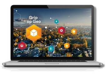
Support your decisions with accessible and reliable geodata
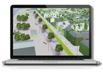
More grip with a digital twin
In the complex reality of a city, different domains are interconnected. To get a grip on this and make decisions about these intertwined domains, more and more cities are turning to a digital twin. Locally organized data in a well-developed, solid Geographic Data Infrastructure (GDI) are indispensable for this.
Geodata 'governance'
Such a GDI ensures that reliable, continuously updated and maintained datasets are easily accessible and usable. The biggest challenge lies in developing methodologies and technologies to organize your data properly.
We support you as a local government in standardizing your geodata, making this data findable and bundling the organizational aspects in a "governance".
We do this in four steps:
1. A GIS audit identifies the strengths and weaknesses of your current system.
2. A roadmap describes the migration from your current situation to a high-performance GDI.
3. You get advice for building your architecture and choosing software.
4. Then follows the implementation of the GDI, integration with other business systems, migration of data and possibly custom software development.
Improve your digital services with smart geodata
Transform your data model
By cleverly combining your geographic data sources, you can transform them into useful information for the service delivery of your city or municipality.
Crucial is structuring geographic databases using formats, objects or relationships. Our experts transform your existing data model into another, more useful or imposed data model.
For example, think about aligning internal data sources with the Flemish OSLO standards such as this one for "Openbaar Domein" (Dutch page).
Optimize your data
Bringing together digital data from different sources or harmonizing multiple datasets into a single entity improves the quality of your data. We support you in integrating your geodata.
The right checks for the best quality
Want to guarantee the quality of your data? Set up the right control mechanisms for your geodata.
This will ensure an optimal dataset for geometry and attributes. When combining multiple sources, in 2D or 3D, we have spotted every inconsistency. Top data guaranteed.
What our clients have to say:
Read how the city of Lier is pioneering a data-driven approach for the public domain.
Find out how the city of Bruges conjures with geo-data thanks to FME.
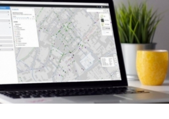
Make geodata accessible
Accessible, quality data
Your geodata are housed in a structural GDI and equipped with all the necessary update and quality control processes. Of course, this makes little sense if the data are not accessible. Employees, citizens and partners also want to be able to use that information.
On your website or in your app
That's why we build user-friendly geo-web applications and mobile applications that you can integrate into your city or municipal website, or on top of your Smart Cities platform.
Organized by domain
To keep an overview for everyone, we develop the applications for different domains such as mobility, charging stations or green in the city. We define these domains together, tailored to the specific needs of your administration.
What our customers have to say:
Read how 4werk simplifies onsite inspection of fire hydrants thanks to a mobile map app.
Contact us
Your input was sent successfully.
Error
Your contact person

An Heirman
+32 (0)16 40 30 39 +32 (0)16 40 30 39
Service Desk
Already a customer? How can we help you?
Service Desk