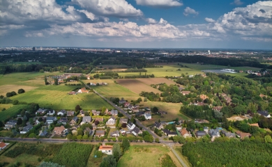
A lot of local authorities struggle to get geodata in order and, for example, to inventory their public domain in detail. But using the software tool FME, Stad Lier managed to quickly automate and integrate complex (geo)data flows. The result: qualitative data for a smart and data-driven policy.
The ambition of city services in Lier is clear: to guarantee efficient operations with a data-driven approach. But the theory is still slightly different from the practice. For instance, the public domain is usually a complicated tangle of data sources that still coexist as silos. This is why the city departments of Strategy and Information, Housing, Environment & Environment and Urban Infrastructure stepped into a cocreation project with GIM. Together they created a tailor-made solution for the city of Lier.
Towards a high-performance (geo)data management system
After discussing the needs and wishes of the City of Lier, GIM developed a plan to optimally open up internal and external geographic information for all parties involved. After all, every employee must be able to consult the necessary data within their own work context at any time and in the most appropriate form. The plan includes these 4 steps:
- Automation of (geo)data flows
As a result, all relevant external data sources are automatically ordered, downloaded and processed in a local database, including history where necessary. An additional quality control ensures that everything runs flawlessly. - Inventory according to OSLO Public Domain
The Flemish programme Open Standards for Linking Organisations (OSLO) sets out the lines for an information model for the inventory of the public domain. GIM implemented a compliant database and through a corresponding QGIS application any user can easily access the data. - Processing of As Built plans
GIM is currently working on the automatic reading and processing of As Built plans of streets and subdivisions, among others. The aim: to automatically check the As Built plans for conformity with the Basiskaart Vlaanderen (GRB) and add them to the Openbaar Domein database. - Creation of an Open Data portal
This portal primarily ensures that all city employees find the required data quickly and easily. They also view it in the desired form. Later, the portal can also be opened up to external users, such as citizens, companies and partners.
Reborn data structure opens perspectives
The automation and integration of the (geo)data - with the software tool FME in the leading role - took place in several iterations. Close cooperation between GIM and Stad Lier, and extensive testing were crucial to arrive at a tailor-made solution. The result is impressive: various work processes (environmental reports, agricultural damage, application processing, etc.) are now fully data-driven and automatic. In addition, achieving policy objectives becomes easier (e.g. environmental monitoring) and the new data structure fits perfectly into the concept of a smart city. Mission accomplished, in other words!
Also automate your geographic data management?
Choose Grip on Geo.
Contact us
Your input was sent successfully.
Error
Your contact person

An Heirman
+32 (0)16 40 30 39 +32 (0)16 40 30 39
Service Desk
Already a customer? How can we help you?
Service Desk