Thanks to artificial intelligence (AI) techniques, more and better information can be derived from satellite imagery and more quickly. This was why GIM, with financial support from the European Space Agency (ESA), commenced a demonstration project using AI techniques to enhance Belmap. This innovative technology opens the door to a series of new applications for utility companies, sustainable energy actors and the insurance sector, among others.
Belmap is GIM's 3D database of all buildings, addresses and related information. It provides the most accurate, complete and up-to-date location-based insights into buildings and addresses for the Benelux.
Using the information collected via AI, Belmap is being expanded to include four new data modules.
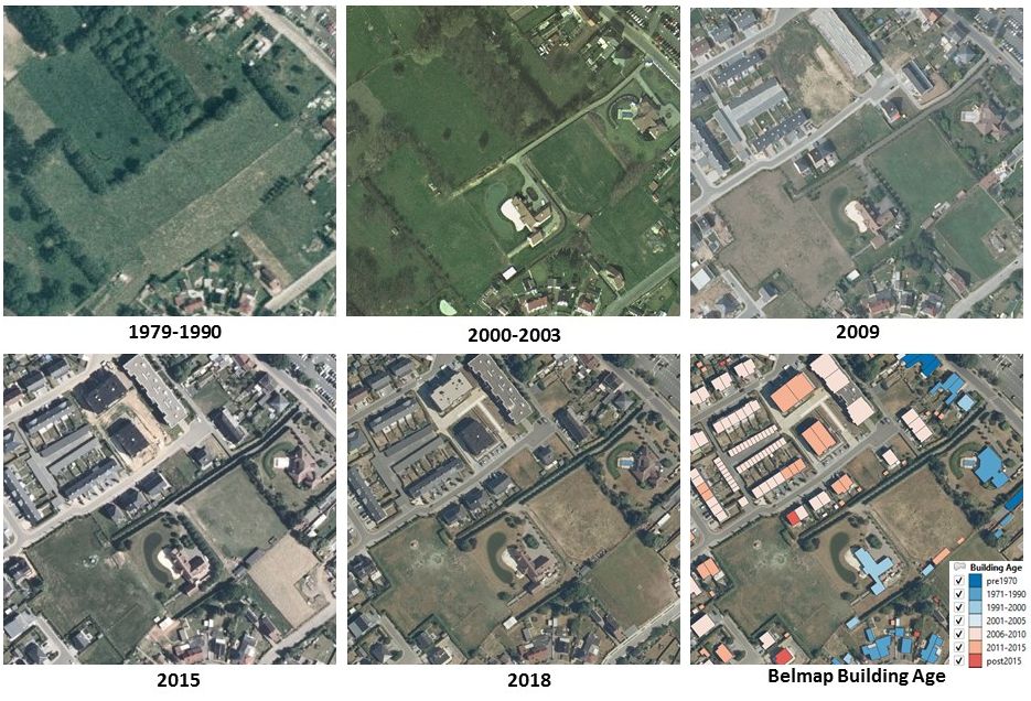
- Building Age: classification of the age of buildings using time series analysis of satellite imagery, aerial photos and historical maps.
- Gardens: land use and ground cover within properties, with information on impenetrable surfaces and the presence of outbuildings and conservatories.
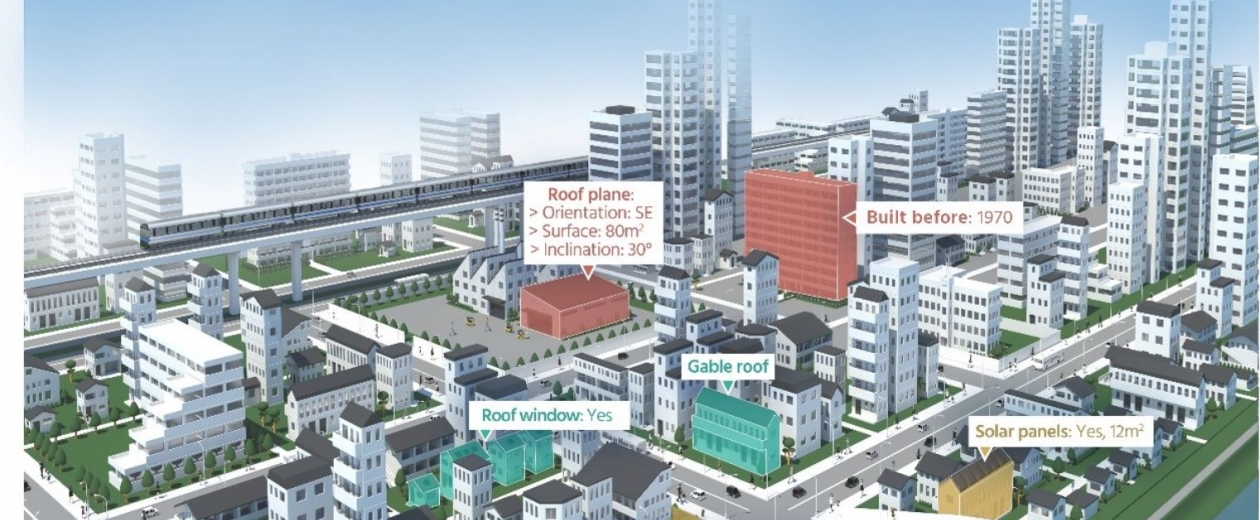
- Roofs: roof properties such as type, surface, slope, orientation, material and countless other characteristics.
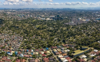
- Greenfields: identification of new allotments and redevelopments in built-up areas using change detection for Earth observation imagery.
Wide range of applications
The new data modules have a great many applications in a range of sectors:
- Banks and insurers: building age, roof properties and information on gardens are of vital importance for determining the value of a home and for evaluating fire and storm-related risks.
- Sustainable energy: the age of a building is an important parameter when estimating its energy-efficiency. Roof information provides useful insights for determining the solar potential.
- Utility companies and telecoms: mapping out greenfield zones in a timely manner is important for the smooth planning, design, roll-out and maintenance of utility lines. Furthermore, information on ground cover allows the installation costs for utilities to be estimated.
Very latest techniques used
The new Belmap modules are developed by combining the existing Belmap data on buildings, land registry properties and roads with a wide range of satellite imagery and orthophotographs. The processing chains are built using artificial intelligence techniques such as Deep Convolutional Neural Networks. Time series analyses are also carried out for the building age and greenfield modules.
Wide-ranging use of satellite imagery
Imagery from Earth observation satellites provides valuable data on the built-up area and covers large territories at very high time frequencies. Data originating from the Sentinel satellites is used to carry out change detection and to identify change hotspot areas. These hotspots are then investigated further in a more purposeful manner, using imagery from commercial Earth observation satellites. They provide imagery at a very high resolution, suitable for mapping out the urban landscape in detail. The historical satellite imagery archives are also used for the Building Age module. These provide a unique picture of how the living environment has changed in the past few decades.
| This project is partially financed by the European Space Agency as part of the ARTES 4.0 Business Applications – Space Solutions programme. The project partners are GIM and Sirris. More information is available on the ESA website. |