Eradicating extreme poverty is the first of 17 Millennium Development Goals formulated by the United Nations in 2016. In many countries, programmes aimed at achieving this objective by 2030 are already under way and cutting-edge technology such as artificial intelligence is also increasingly being used for this purpose. As a specialist in geographic information, GIM set up an image processing chain that uses satellite or aerial images to automatically determine the size and location of informal settlement districts. Local authorities and NGOs are starting to make use of this technology in order to invigorate its approach toward combating poverty.
Satellite imagery has been used for many years to gather information about the Earth's surface and the human activities taking place there. Until recently, experts relied on software that recognises and delineates certain spatial patterns. This Object Based Image Recognition represented a major step forward in speeding up information processing. The disadvantage of that process is that a relatively large amount of human intervention is still required and that the processing logic must be set up and tested from scratch for every project. Moreover, processing the information requires an enormous amount of computing power.
Machine learning comes to the rescue
The breakthrough of artificial intelligence – specifically machine learning – represents a huge step forward when it comes to processing large amounts of information. GIM's data scientists set up a series of processing chains that make use of computer vision to scan high-quality aerial or satellite images for the presence of objects such as buildings, vegetation, paved and unpaved surfaces, and so on.
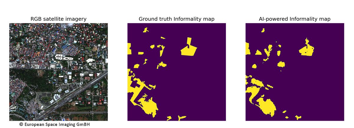
For this application, the model was trained to recognise the typical characteristics of informal settlement districts , such as narrow alleys and small contiguous houses with a wide variety of roof structures, completely automatically.
.png)
Belgian know-how deployed worldwide
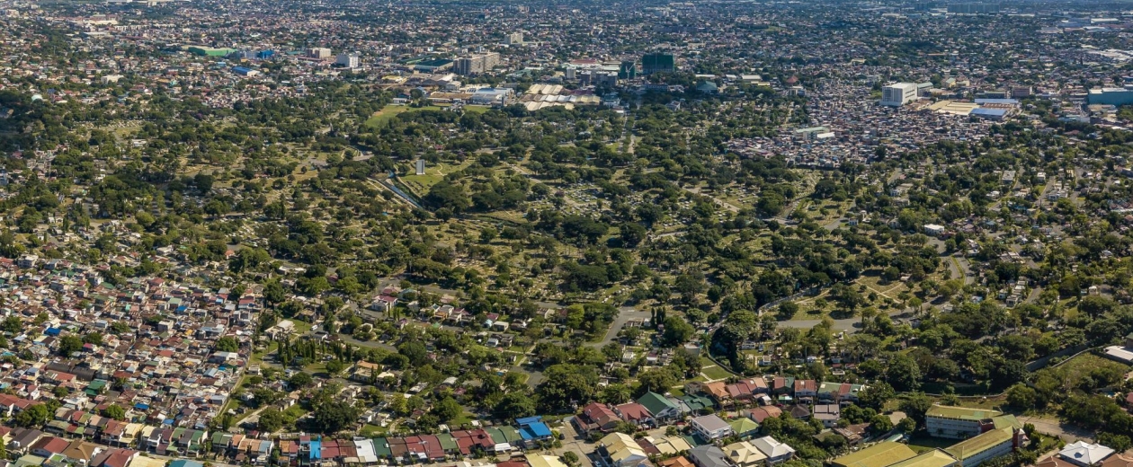
GIM used this technology to demarcate informal settlements in Manila (Philippines), Ho Chi Minh City (Vietnam) and in Latin America. As far as Manila and Ho Chi Minh City are concerned, GIM was working on behalf of the UNDP (United Nations Development Program), while in Latin America, the Inter-American Development Bank (IDB) is coordinating the project.
The great advantage of the method used is that once developed, the model can easily be transferred to another region or continent. Thanks to machine learning, detecting informal habitation of this type is also faster, easier and more accurate. Moreover, the partners receive an extensive toolbox that enable the software to be deployed in additional locations or enable changes to be monitored over time. The ultimate benefit is that this toolbox is based on open-source tools, which also makes the technology particularly attractive to NGOs, which often operate in regions where fewer financial resources are available.

Want to know more about the use of machine learning for object detection?
Please don't hesitate to contact GIM or watch our webinar on artificial intelligence for geo.