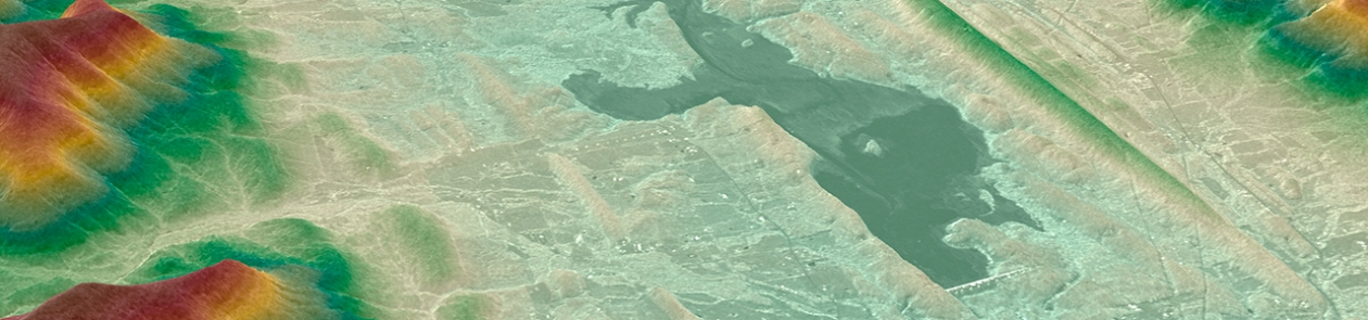
Digital Elevation Model
Digital Elevation Model: insight into the topography of an area
Interested?
Rendering an area as a 3D surface with its topographical features enables you to acquire trail-blazing geo-insights.
A Digital Elevation Model is a digital representation of the relief of a terrain that is used to carry out projects in a wide range of fields, including civil engineering, town and country planning, telecoms, energy transport, academic research, etc.
There are two types of Digital Elevation Model:
- The Digital Surface Model (DSM) characterises the surface of a plot of land, including elevated objects such as buildings, vegetation, etc.
- The Digital Terrain Model (DTM), which represents the bare surface of the terrain obtained after removing all the objects present in the DSM.
In addition to these Digital Elevation Models, GIM can also provide you with 3D models representing buildings, among other things. We will be happy to discuss your requirements and work with you to find the best way to meet the specific needs of your projects.