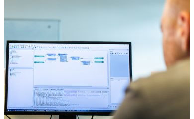
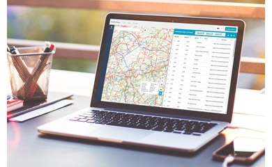
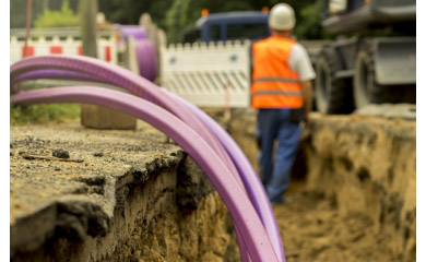
vGIS: Augmented Reality for GIS and BIM

Interested?

Would you like to determine the exact location of underground cables and pipes before the start of your excavation works? Display realistic BIM models in their urban context? Thanks to Augmented Reality, you can conjure up the invisible on your smartphone or tablet in the blink of an eye. GIM is able to prepare your GIS and BIM data and display these in the powerful Augmented Reality app of vGIS. In addition you can create and display a reliable 3D image of your underground infrastructure thanks to the reality capture features of VGIS.

Maintaining underground cables and pipelines and aboveground infrastructure is a time-consuming task. Often this infrastructure is not easily accessible, and its maintenance is complex due to the urban environment where many utilities are lying in close proximity of each other. Maintenance staff often have a limited view of the actual situation in the subsurface, resulting in the risk of excavation damage. The challenge is to keep maintenance costs low and ensure the efficiency and safety of staff.

See the unseen with Augmented Reality

With Augmented Reality (AR), you can project digital objects onto real-time images. It helps infrastructure managers to work more efficiently, save costs and increase the safety of their staff:

  • Visualise digital maps in the real world and determine exactly where and how you need to carry out maintenance.
  • Add annotations, photos, audio clips and mark-ups in real time to your asset database.
  • Document existing infrastructure with Reality Capture and add the 3D images to your asset database.
  • Project 3D images of the underground situation on the site.
  • Project BIM designs into the real world prior to construction so you can engage stakeholders and detect conflicts early in the design process.

High accuracy guaranteed with vGIS

vGIS offers an easy-to-use and highly accurate Augmented Reality solution that uses a device you already have in your pocket: a smartphone, a tablet or a more sophisticated device, like Microsoft's Hololens. The app is compatible with mid-range Android and iOS smartphones and tablets. It is complemented by a Software as a Service platform to manage your organisation's devices, users and data.

Discover in this video how vGIS Augmented Reality can display your GIS and BIM data.

Reliable GIS and BIM data as raw material

To enjoy the accuracy of the vGIS platform, you must, of course, be able to rely on high quality data. GIM's data engineers ensure that your GIS and BIM data are in optimal shape for a smooth transfer to the AR platform. On the other hand, they ensure that the 3D images collected by field staff using the vGIS app are automatically fed into your asset database.

Would you also like to gain a better view of your (underground) infrastructure? Contact us now

Contact us

All fields are required

Your input was sent successfully.

Error

GIM respects your privacy. We collect your data in order to process your request. We might also keep you informed about GIM's products or services. We will not pass on your data to other organisations under any circumstances. You are entitled to review your data and withdraw your consent for its processing.  Consult GIM's privacy policy for more information.

  • Your contact person

    Bart Tuyteleers

    Bart Tuyteleers

    Business Development Manager

    016403039 016403039

    Service Desk

    Already a customer? How can we help you?

    Service Desk