Artificial intelligence for geodata
Artificial intelligence (AI) and geodata: a powerful combo
Geo-AI is the art of applying Artificial Intelligence techniques to large volumes of geographic data to solve spatial problems. The most well-known are undoubtedly Computer Vision techniques. But GeoAI is so much more. Through time series analysis and predictive modelling, we manage to enrich geodata even more and anticipate future developments.
Seeing more with computer vision
Computer vision is modelled on how the human brain works to extract information from digital images. It combines a series of image filters stacked in so-called deep convolutional or transformer-based networks. These networks are specifically trained to identify features from images.
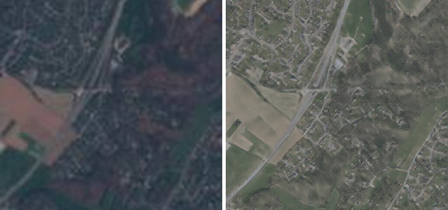
Applying these techniques to aerial photographs and satellite images, we can gather information useful for a whole range of applications.
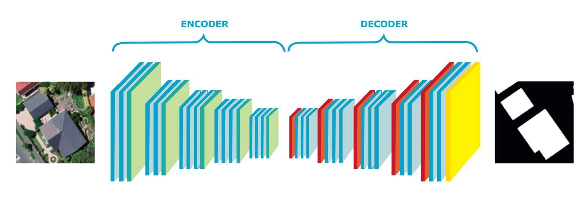
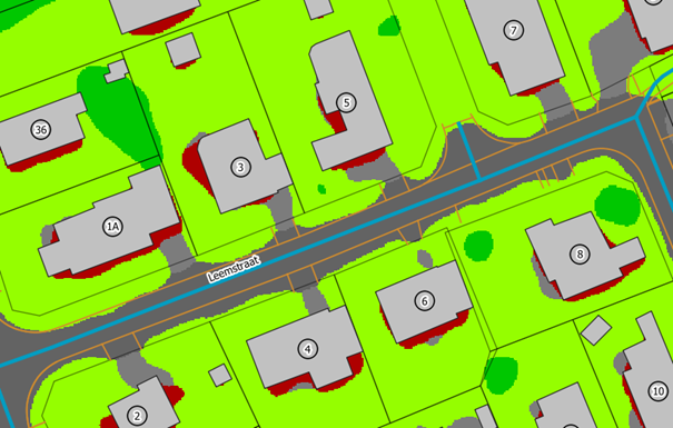
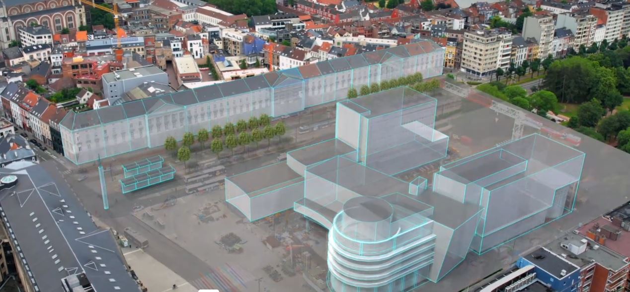
Detecting buildingsA neural network maps each pixel of an aerial photo and checks whether or not it belongs to a building. The result is compared with existing building polygons. |
 |
Determining the age of buildingsBy repeating building detection on time series of topographic maps, orthophotos and satellite images, you determine for each building in which period it was built. |
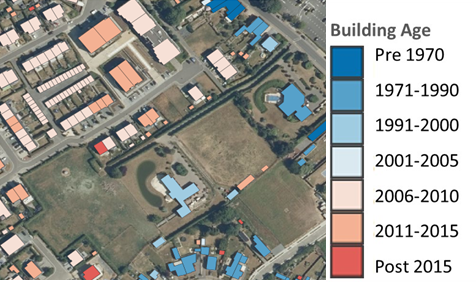 |
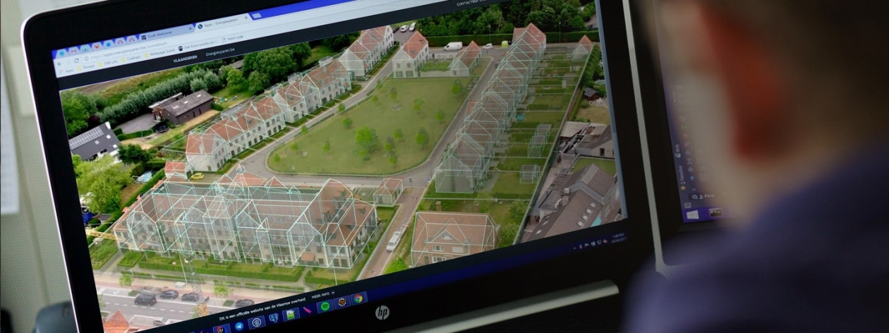
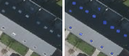
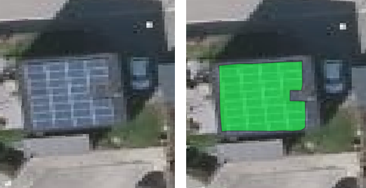
Identifying roof objectsComputer vision identifies even smaller objects on roofs, such as solar panels, skylights and air conditioning units. We integrate this information in Belmap, among other things, to determine the energy potential and energy consumption of buildings. |
|
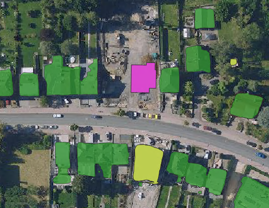
Determining ground coverIn a so-called multiclass image segmentation, each pixel of an image is assigned to the most likely category. The result: a highly detailed land cover map. |
 |
Analysing mobile imagesComputer vision is not fussy. It works with images collected from professional 360° cameras as well as smartphone photos. These images allow you to assess the quality of the road surface or identify road signs, street markings, trees and street furniture ... |
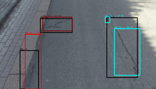 |
Magic with pixels thanks to super resolution
How accurately you do image recognition depends largely on the image resolution. No high resolution available? No worries, computer vision can artificially increase the resolution of imagery by a factor of 4.
Computers predict the future
Geo-AI is not limited to computer vision. Language processing (natural language processing) techniques scan documents in search of geographical content. Time series analysis detects patterns and makes predictions for future traffic flows, parking occupancy or urban heat stress.
Machine learning techniques are also used to predict properties of objects such as, for example, the value and energy performance of buildings. Models are trained on known information about existing buildings. For example, the model learns to link a set of basic properties such as volume, type, age, nature and roof characteristics to energy performance. Once trained, the models are deployed to estimate the performance of the entire building stock.
Also gain stronger insights through Geo-AI?
Contact us
Your input was sent successfully.
Error
Your contact person

Steven Smolders
+32 49 8976843 +32 49 8976843
Service Desk
Already a customer? How can we help you?
Service Desk